Suitability Modeler vs. Raster Calculator
The Suitability Modeler and the Raster Calculator are GIS tools that can create a raster using pre-existing raster layers.
With the Suitability Modeler, the user may apply different weights to layers. The modeler creates a distribution that integrates the weights and outputs a choropleth raster. The tool accommodates seamless back-and-forth usage.
The Raster Calculator requires mathematical and manual tuning for raster customization. As with many geoprocessing tools, users must input the layers in an expression and use appropriate operations and numerical values.
ModelBuilder has Raster Calculator integration, allowing variables to be used as an input and for layers. As the user selects variables, they are linked to the Raster Calculator tool and instantly listed in the tool's variable list. Similarly, if a variable is used in an expression, it becomes linked to the tool; deleting a variable from an expression unlinks the two. The expression will be invalid if the user renames a variable already linked to the Raster Calculator.
Suitability Analysis Considerations
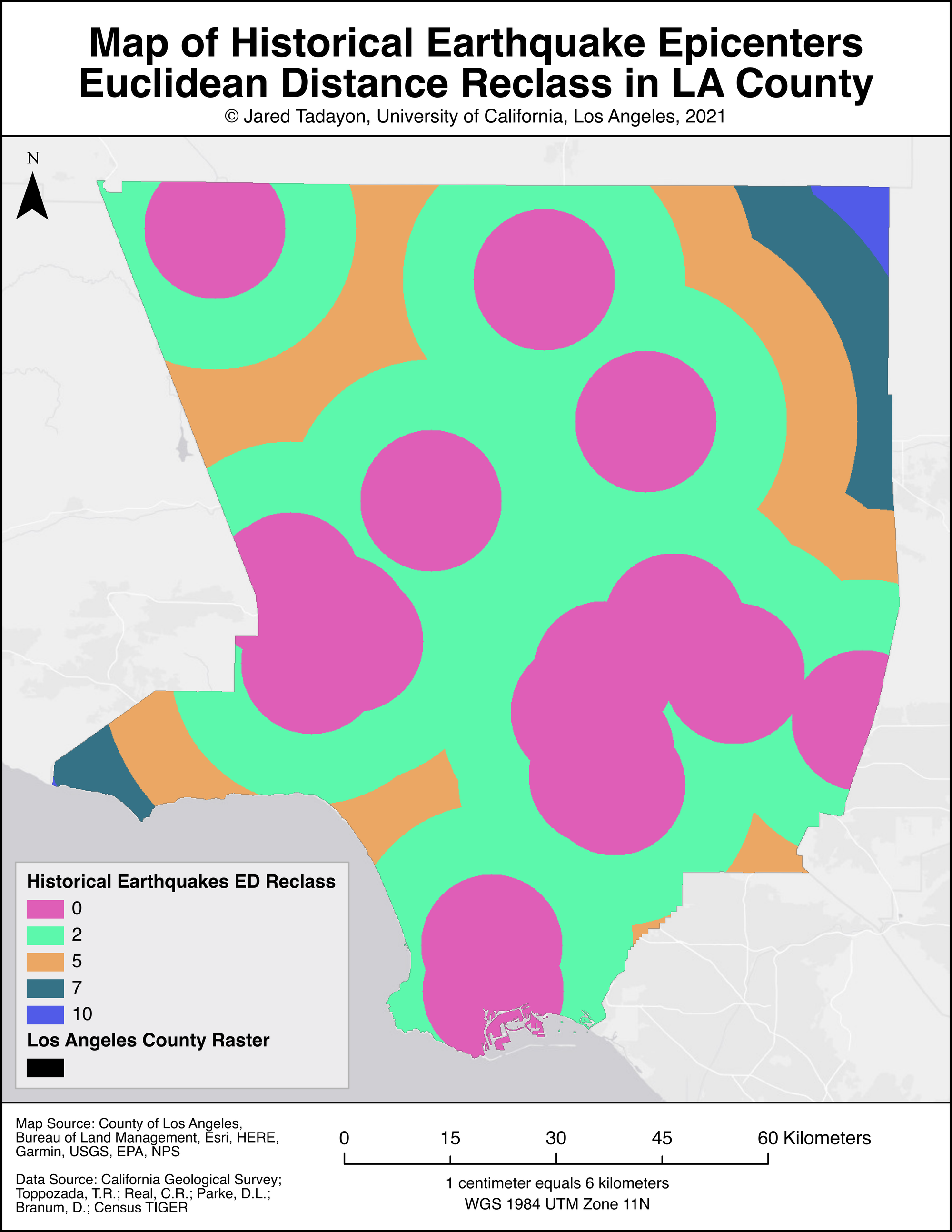
For this tutorial, I use these tools to find an earthquake-free location in Los Angeles County for a new college campus. For the suitability analysis, I base it on historical earthquake epicenters (using Euclidean Distance), a 2 kilometer buffer from highways, and an elevation slope. I will begin by reclassing all three. I reclass the historical earthquake ED. to values of 0, 2, 5, 7, and 10. Next, I reclass the highway buffer to 0 and 10; 0 represents the highway, while 10 represents the area 2 miles outside the highway. A reclass of the elevation slope has values of 0, 4, 8, and 10.
Weights and Suitability Score
Providing a weight to each class informs the tool of priority and importance. I weigh 50% for the highway buffer, 30% for the elevation slope, and 20% for the earthquake epicenter ED. The campus location should be close to a highway but far enough to not overlap a major road; therefore, the highway buffer is given the highest weight. And ideally, the campus should be on a flat location; so elevation weight will be 30%. As for earthquakes, although the campus should be far from historical earthquake zones in the event of reoccurance, the free-zone is comparatively small and inaccessible for a campus. Therefore, the earthquake epicenter ED is given a 20% weight.
Concluding Remarks
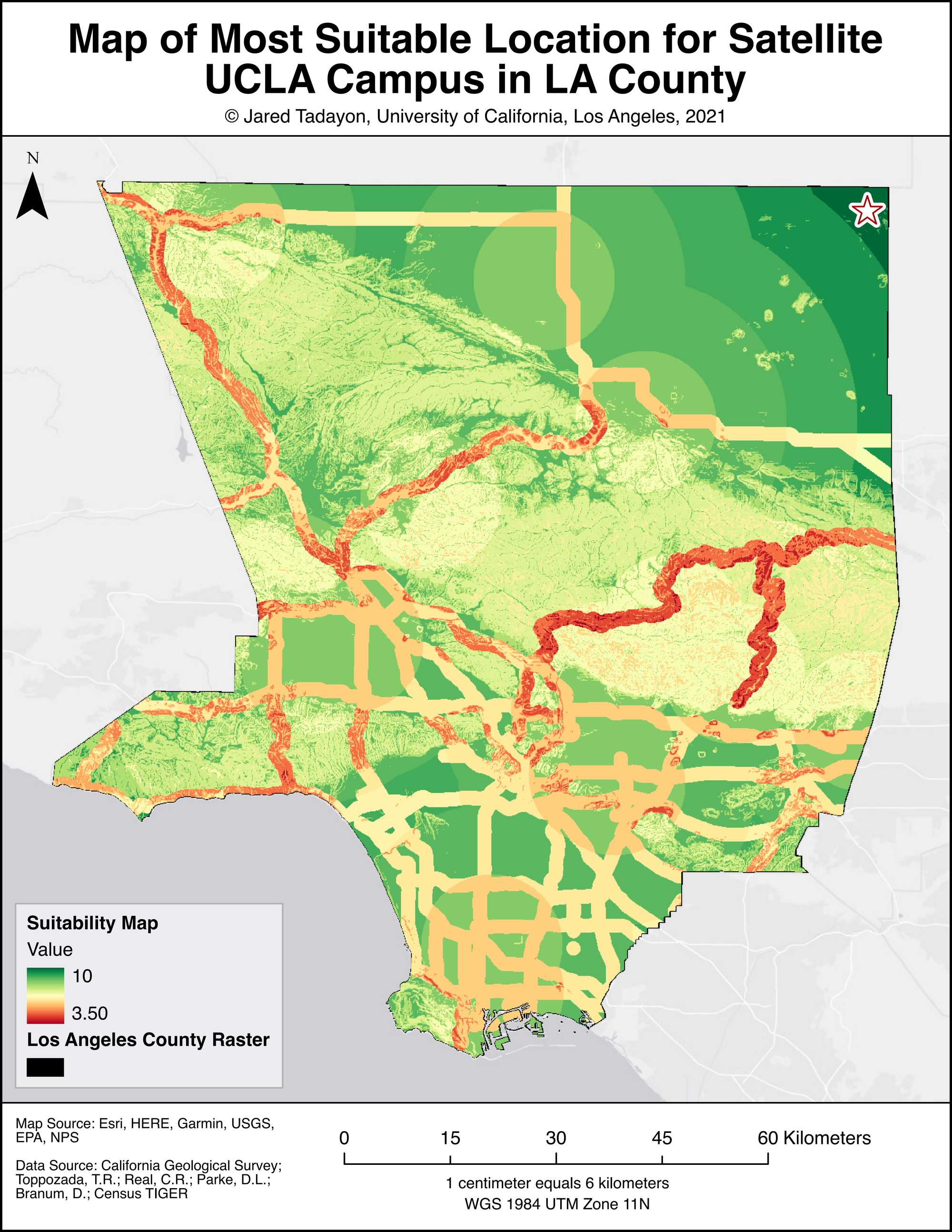
The resulting output of the suitability analysis makes sense when considering the class weights. The location is out of the way from highways, sites of historic major earthquakes, and mountainous terrain. Since I don't account for LA County's large size, the resulting site is in the desert. Being north of the Transverse mountain ranges, it is far from populated urban centers and would likely be an inconveince for most residents. This dilemma can be fixed with a raster layer based on population data, followed by an appropraite re-weight for each class in the Suitability Analysis tool.